

How to grow watermelon: a commercial guide
Watermelon is a warm-season, deep-rooted vine grown on plastic mulch from transplants. The decisions that matter are planting after frost into warm soil, the spacing for your fruit size, a pollenizer plan for seedless types, and picking at the right maturity. Figures are Midwest and Pennsylvania commercial practice.
Scope: Commercial field watermelon, northern US. Southern production differs in dates and cultivars. Updated 2026-10-16.
At a glance
- Spacing
- Rows 1.8–3.7 m (6–12 ft), plants 0.9–1.8 m (3–6 ft) apart, one plant per hill; Penn State 6,920–10,870 plants per ha (2,800–4,400 plants/acre)1,2
- Days to maturity
- 68–92 days depending on variety2
- US average yield, 2025
- About 43.8 t/ha (391 cwt/acre); 1.76 million t (38.7 million cwt) from 40,000 ha harvested (98,900 acres)3
Seeded, seedless and mini types
- Mini (personal size)2.7–3.2 kg
- Standard seedless4.1–9.1 kg
- Seeded (can exceed)9.1 kgmay be over 9.1 kg (20 lb)
- Seeded versus seedless
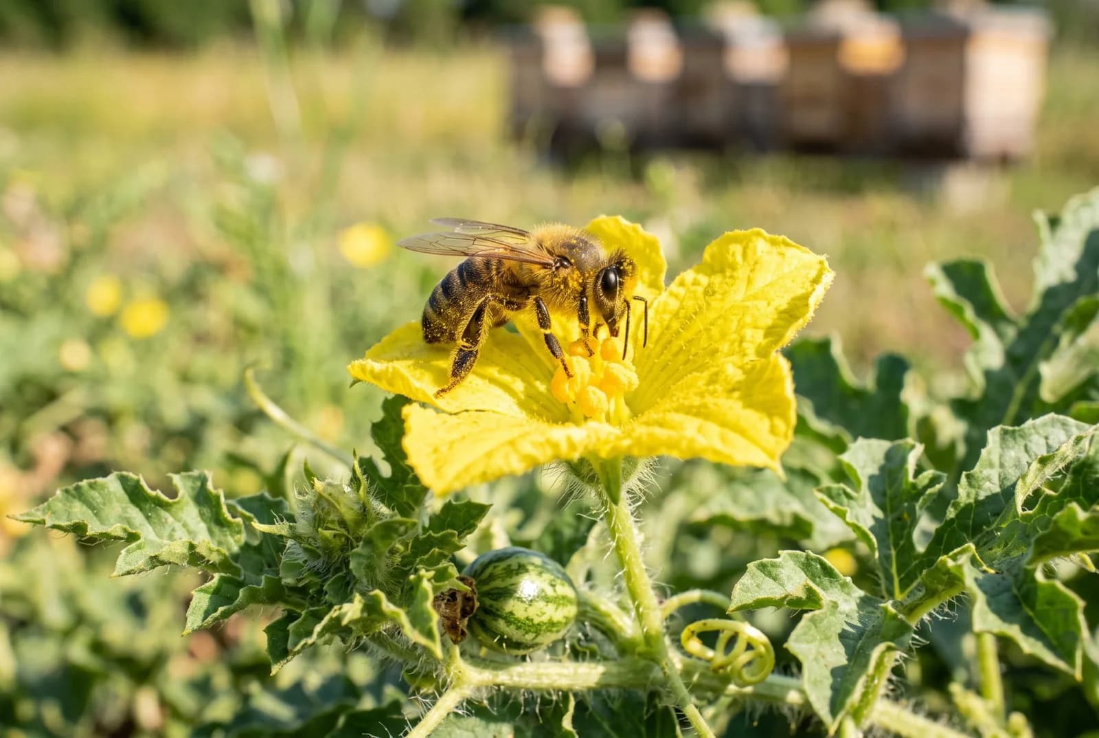
- Watermelons are seeded (diploid) or seedless (triploid). Seedless plants make non-viable pollen, so a seeded variety or a non-edible pollenizer must be planted nearby for the fruit to set. Order pollenizer seed with the seedless seed.1
- Flesh and rind
- Standard types have striped rinds on dark or light green, but some, such as Sweet Gem, have a plain dark green rind. Red flesh is most familiar; yellow, orange and white flesh types exist.1
- Match the type to the buyer
- Fruit size and shape differ by variety and region, so check seed-company information and the Midwest Vegetable Trial Report before choosing.1
Transplant into warm soil on plastic mulch
Between rows: 1.8–3.7 m (6–12 ft) · Within the row: 0.9–1.8 m (3–6 ft)
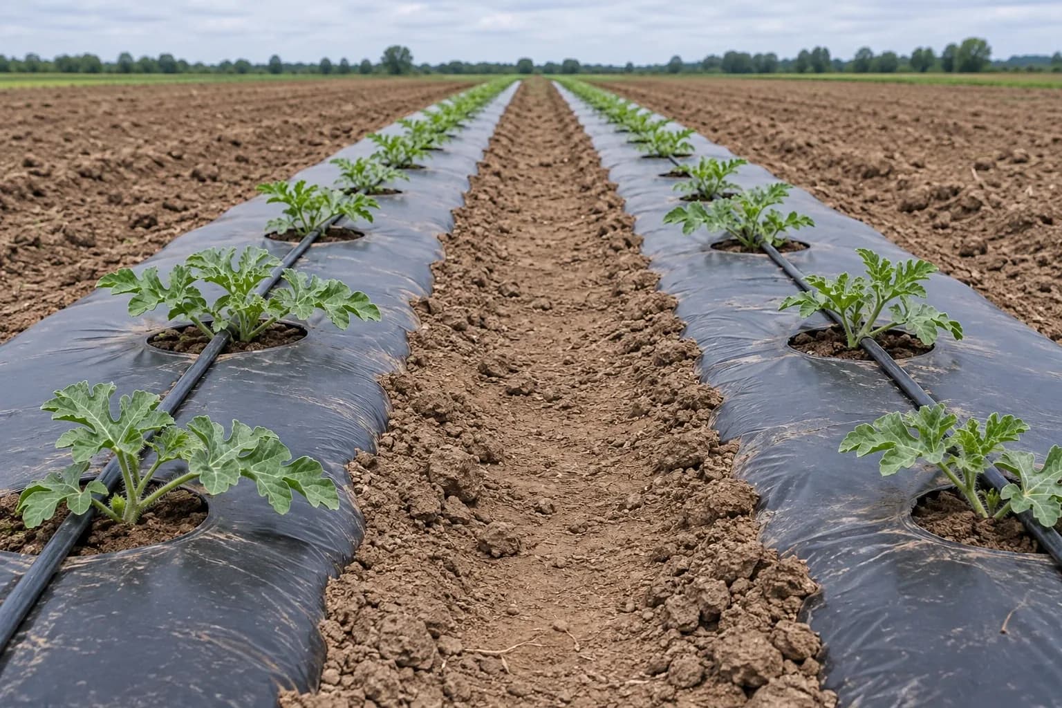
Rows 1.8–3.7 m (6–12 ft) apart and plants 0.9–1.8 m (3–6 ft) apart with one plant per hill. Mini types: rows 1.8–3 m (6–10 ft), plants 0.5–0.6 m (1.5–2 ft), 1.1–1.4 m² (12–15 sq ft) per plant. Schematic, not to scale.
- Date and temperature
- Plant after the danger of frost is past. Air temperatures below 10°C (50°F) cause chilling injury, and direct-seeded crops need soil above 16°C (60°F); Penn State waits until soil 7.5 cm (3 inches) deep reaches 16°C (60°F) before transplanting seedless types.1,2
- Transplants and mulch
- Transplants are often used, grown in the greenhouse for about 4 weeks (Penn State: 18–24 days at 24–32°C (75–90°F) container soil). Plastic mulch is recommended for all transplanted watermelons.1,2
- Population
- The Midwest guide gives rows 1.8–3.7 m (6–12 ft) apart and plants 0.9–1.8 m (3–6 ft) apart. Penn State lists 6,920–10,870 plants per ha (2,800–4,400 plants per acre) in single rows 1.5–2.4 m (5–8 ft) apart with 61–91 cm (24–36 inches) between plants. The two differ, so use the recommendation for your region and fruit size.1,2
Plan pollination for seedless types
Feed and water
- Soil pH
- Maintain pH 6.0–6.8 (6.3–6.8 for melons). Below 5.5 can cause manganese toxicity, and melons are particularly sensitive to low pH.1
- Nutrient uptake
- Melon, watermelon, pumpkin and squash crops accumulate roughly 165–180 kg/ha (145–160 lb/acre) N, 34–50 kg/ha (30–45 lb/acre) P2O5 and 180–200 kg K2O/ha (160–180 lb K2O per acre) in vines and fruit. Adjust N for soil organic matter and credits; set P and K by soil test.1
- Programmes
- On plastic with drip, apply 34–39 kg/ha (30–35 lb/acre) N before planting and fertigate 0.6–2.2 kg N/ha (0.5–2 lb N per acre) per day. On plastic without irrigation, up to 110 kg/ha (100 lb/acre) N preplant and 34–50 kg/ha (30–45 lb/acre) sidedressed later. Penn State: 40-50-50 banded at planting and 30-50-50 injected, no more than 5.6–7.8 kg/ha (5–7 lb/acre) N per application.1,2
- Water
- Watermelons are deep-rooted, so rainfall is often adequate and irrigation may not pay on heavier soils. Moisture matters most early for vigorous growth and during blossoming and fruit development.1
Scout cucumber beetles and drainage
- Cucumber beetle thresholds
- From seedling to the 4-leaf stage treat at 1 beetle per plant; from 4-leaf to harvest treat at 5 per plant. Weekly scouting is enough. Contact insecticides go on in the evening when bees are not foraging.1
- Phytophthora
- Phytophthora blight follows heavy rain and poor drainage, starting in low spots. Avoid fields with a history of it, disinfest hands after touching an infected fruit and keep harvested fruit dry.1
Harvest and store
- 1
Transplant
After frost, soil above 16°C (60°F), on plastic mulch.
- 2
Pollinate
About 2.5 hives per hectare; pollenizers for seedless types.
- 3
Grow
68–92 days to maturity depending on variety.
- 4
Judge maturity
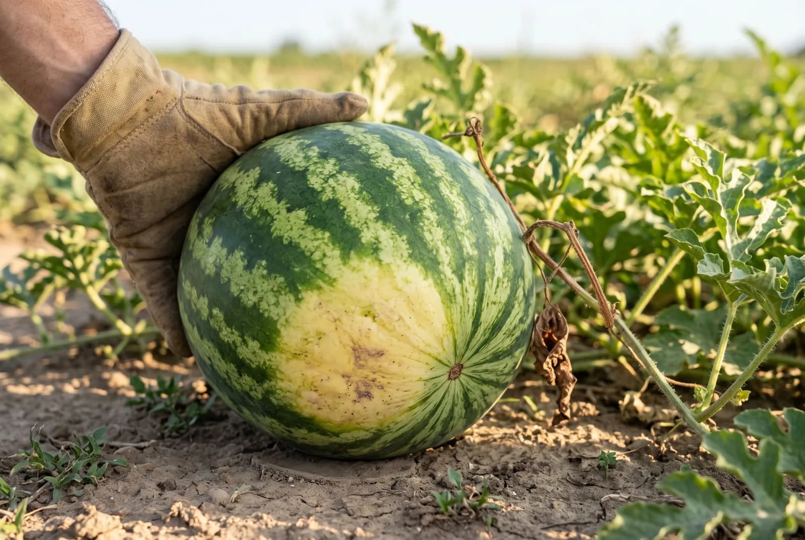
Ground spot white to yellow, tendril nearest the fruit brown, dull hollow sound when thumped.
- 5
Cut and cool
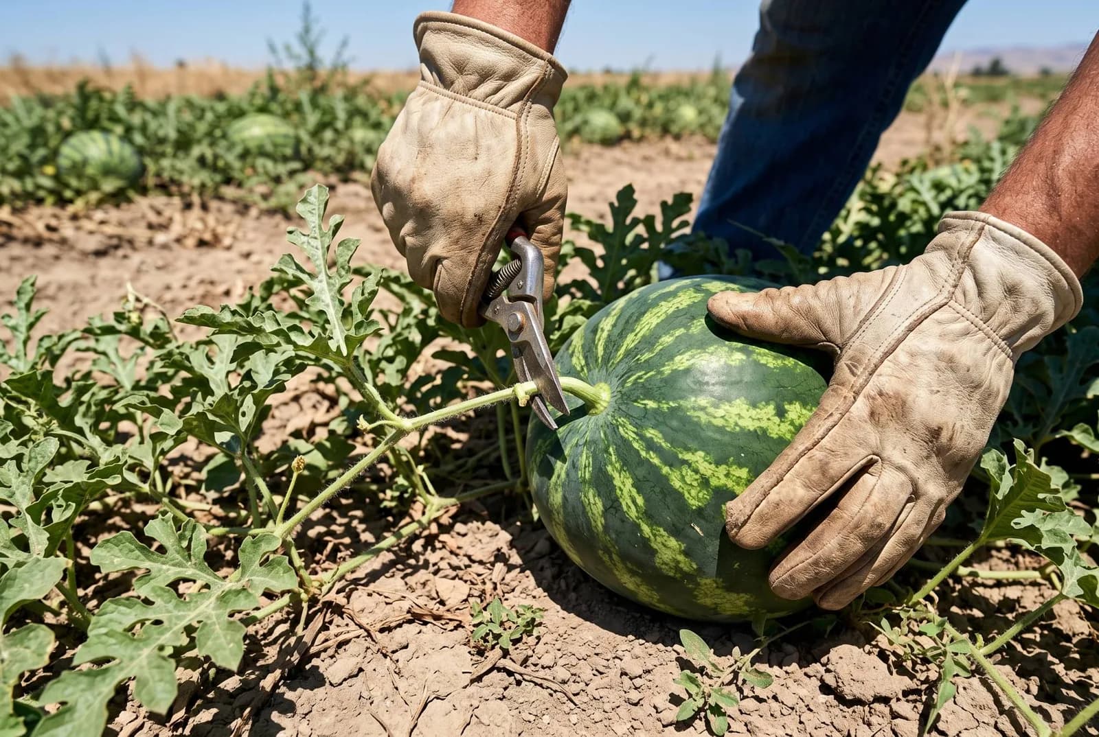
Cut from the vine leaving 2.5–5 cm (1–2 in) of stem; cool to 7–10°C (45–50°F).
- 6
Store
8–13°C (47–55°F) at 85–90% humidity for 21–28 days.
- Maturity is hard to judge
- The Midwest guide calls picking at the right stage critical and difficult. Use several signs together: the ground spot changing from white to yellow, browning of the tendrils nearest the fruit, and a dull or hollow sound when thumped.1,2
- Cut, do not pull
- Cut fruit from the plant, leaving 2.5–5 cm (1–2 inches) of stem, to avoid vine damage and stem-end rot.1
- Cooling and storage
- Penn State recommends cooling to 7–10°C (45–50°F) to remove field heat. Fruit keeps 21–28 days at 8–13°C (47–55°F) and 85–90% humidity.2
Yield and economics
US watermelon production in 2025 was 1.76 million t (38.7 million cwt) from 40,000 ha harvested (98,900 acres; 102,900 acres or about 41,600 ha planted), worth $741 million. That is about 43.8 t/ha (391 cwt per acre) as a national average, all for the fresh market.
- What drives margin
- Seedless seed, transplants, plastic and drip are large per-hectare costs, and price is set by fruit size and market timing. Put your own numbers into the crop ROI estimator before choosing acreage.3
Frequently asked questions
- When do you plant watermelon?
- After the danger of frost, once soil 7.5 cm (3 inches) deep is above 16°C (60°F) and nights stay above 10°C (50°F). Transplants are usually grown about 4 weeks first.
- How far apart do you plant watermelons?
- The Midwest guide gives rows 1.8–3.7 m (6–12 feet) apart with plants 0.9–1.8 m (3–6 feet) apart, one plant per hill. Penn State uses 6,920–10,870 plants per ha (2,800–4,400 plants per acre) in rows 1.5–2.4 m (5–8 feet) apart.
- How long does watermelon take to grow?
- About 68–92 days from transplanting depending on variety, per Penn State.
- How do you know when a watermelon is ripe?
- The ground spot turns from white to yellow, the tendril nearest the fruit browns and dries, and the fruit sounds dull or hollow when thumped.
- Do seedless watermelons need a pollenizer?
- Yes. Plant one pollenizer for every two to four seedless plants, or one seeded row for every two to four seedless rows, and use about 2.5 bee hives per hectare (one per acre).
- How long does watermelon keep?
- About 21–28 days at 8–13°C (47–55°F) and 85–90% humidity after cooling to 7–10°C (45–50°F).
Regional guides and field planning
Sources and image credits
- 1. Midwest Vegetable Production Guide 2026 — Cucurbit Crops: Horticulture, Diseases and Insects — 2026 edition; horticulture reviewed 2022, diseases 2023, insects 2025. Midwest commercial melons, watermelon, pumpkins and squash: types, planting dates, spacing, fertility, harvest signs, bacterial wilt, Phytophthora, powdery mildew and cucumber-beetle thresholds.
- 2. Penn State Extension — Watermelon Production — Accessed 1 October 2026. Pennsylvania transplanting temperature, plant population, hive and pollenizer ratios, fertility, harvest signs, cooling and storage.
- 3. USDA NASS — Vegetables 2025 Summary — Published February 2026. US planted and harvested area, production and value; per-acre yields here are derived as production ÷ harvested acres.
Image credits
- Ripe fruit: the ground spot has turned from white to yellow and the tendril nearest the fruit has dried and browned.
- Transplants set through black plastic mulch with a drip line, the setup the Midwest guide recommends for all transplanted watermelons.
- Honeybees do the pollinating; Penn State recommends about 2.5 hives per hectare (one per acre).
- Cut the fruit from the vine, leaving 2.5–5 cm (1–2 inches) of stem, rather than pulling it.
Figures are published averages or study assumptions for the places named, not guarantees for your field. Check current local recommendations and product labels before acting.
Some visuals in this guide are illustrations rather than photographs of a specific farm. See image credits.